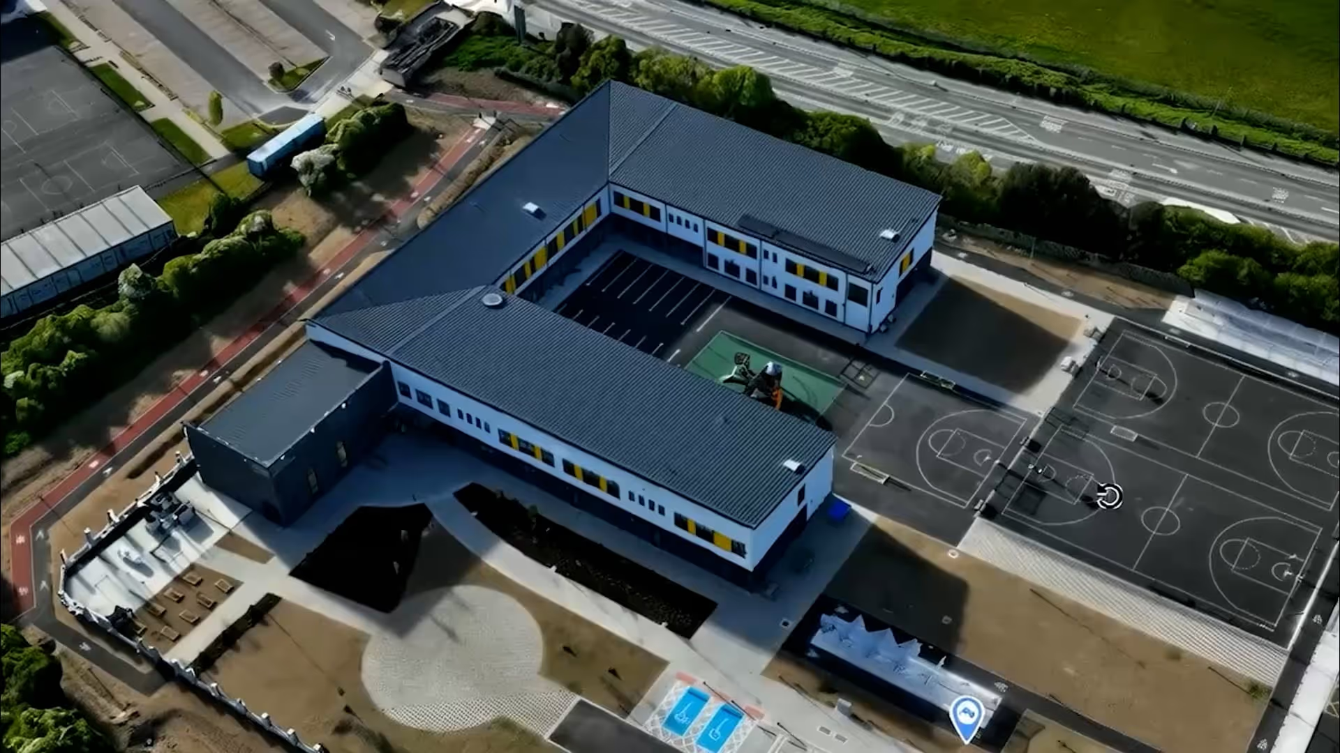
Precise Aerial Intelligence with Drone Views
Professional drone mapping and surveying services that deliver accurate, comprehensive site data in a fraction of the time of traditional methods.
Customer-Reported Results
1M+
View and Inspect Work Remotely
360°
Reduce Manual Site Surveys
24-48h
Perform Safe Checks in Inaccessible Areas
80%
Consistently Track Progress
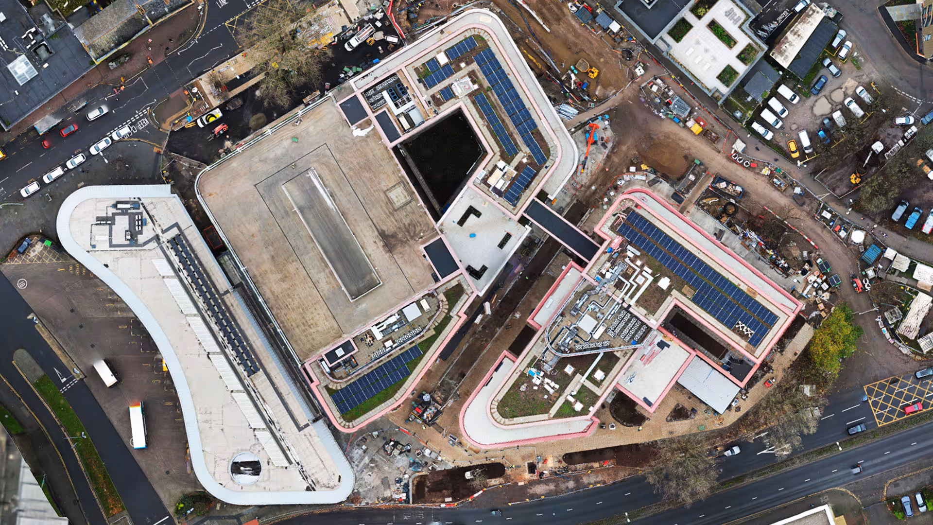
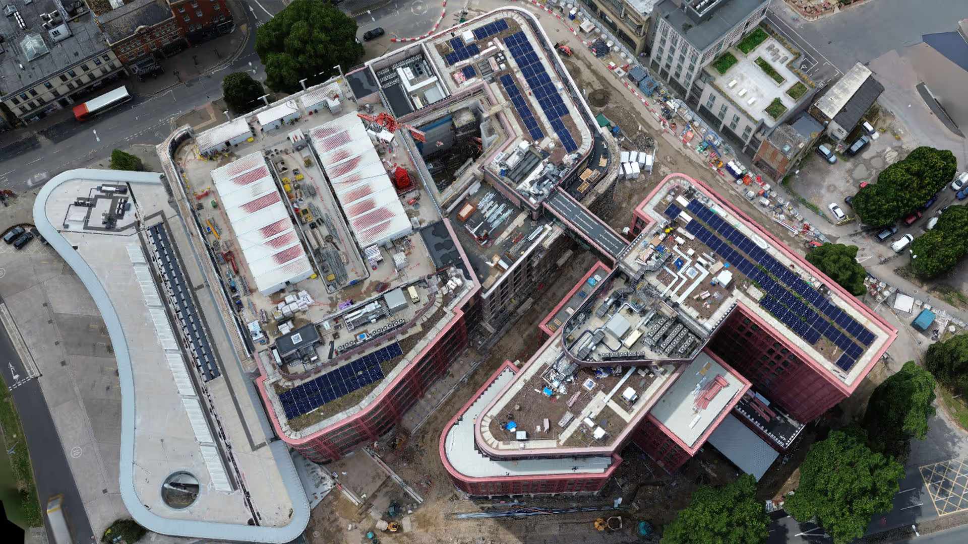
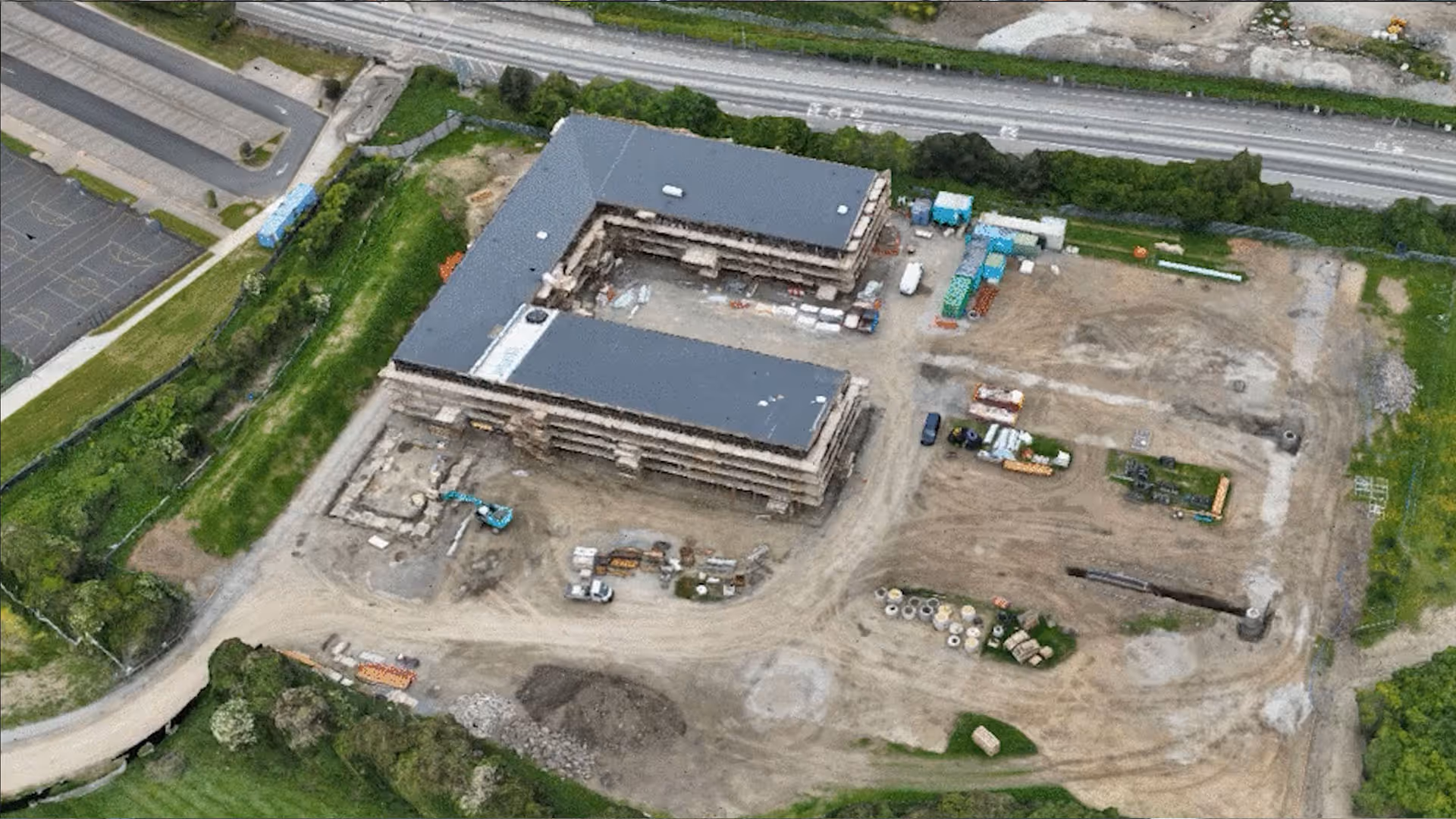
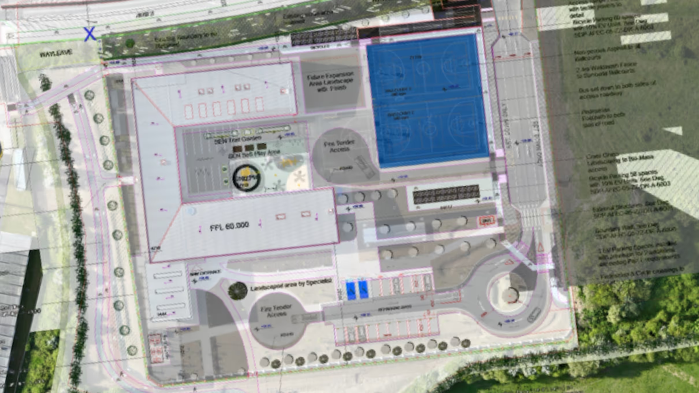
Orthomosaic Mapping
Get more done with Evercam
High-resolution 2D maps created from hundreds of aerial photos provide accurate site documentation
4-6 cm per pixel accuracy
TIFF export format
Plan overlay compatibility
Progress comparison tools
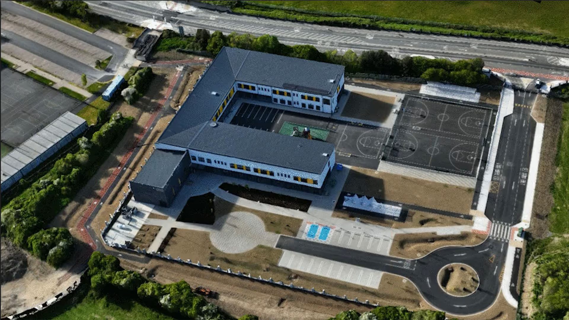
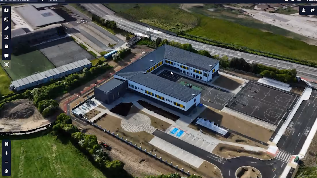
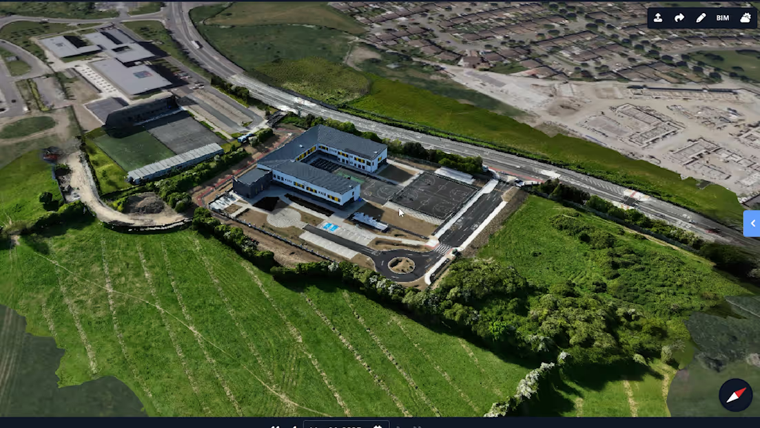
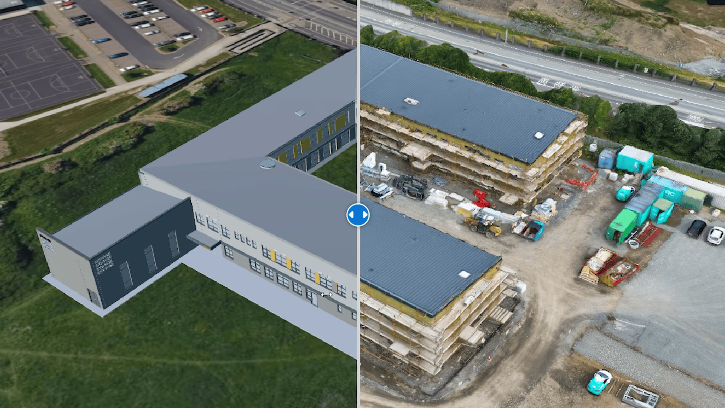
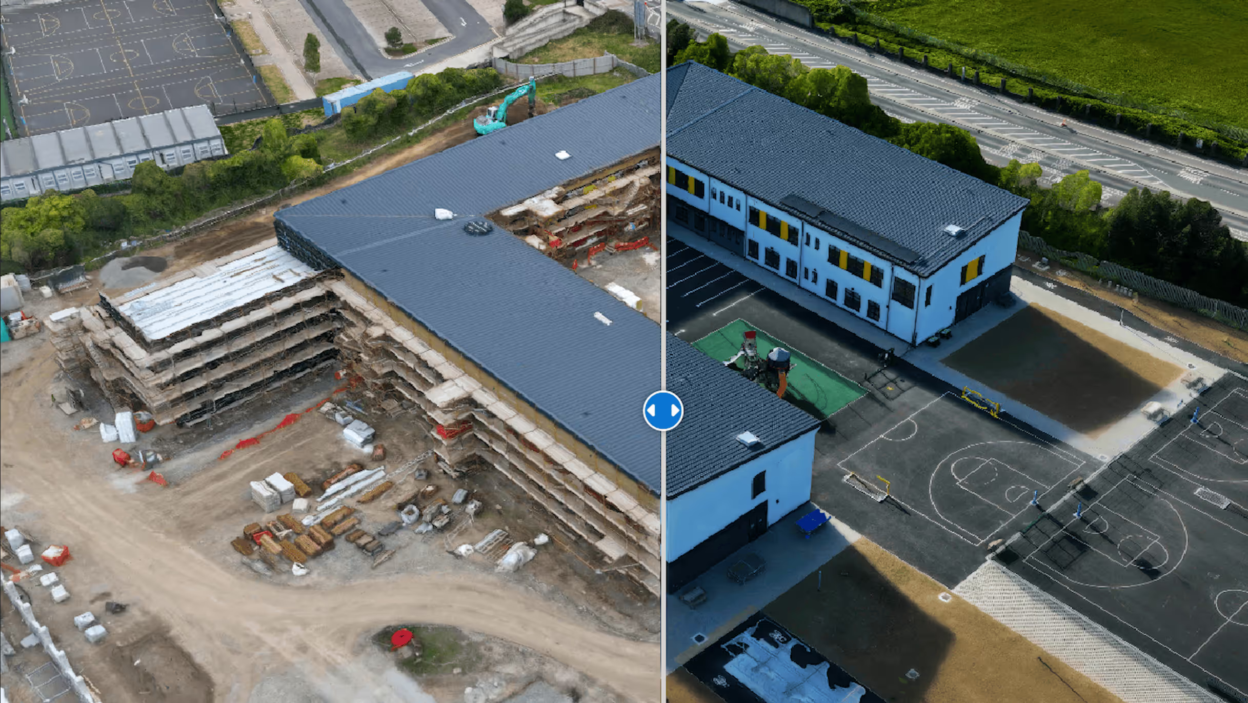
3D Site Models
Get more done with Evercam
Detailed 3D reconstructions of your site using photogrammetry
Export and share
Textured 3D mesh models
Markup
BIM comparison overlay
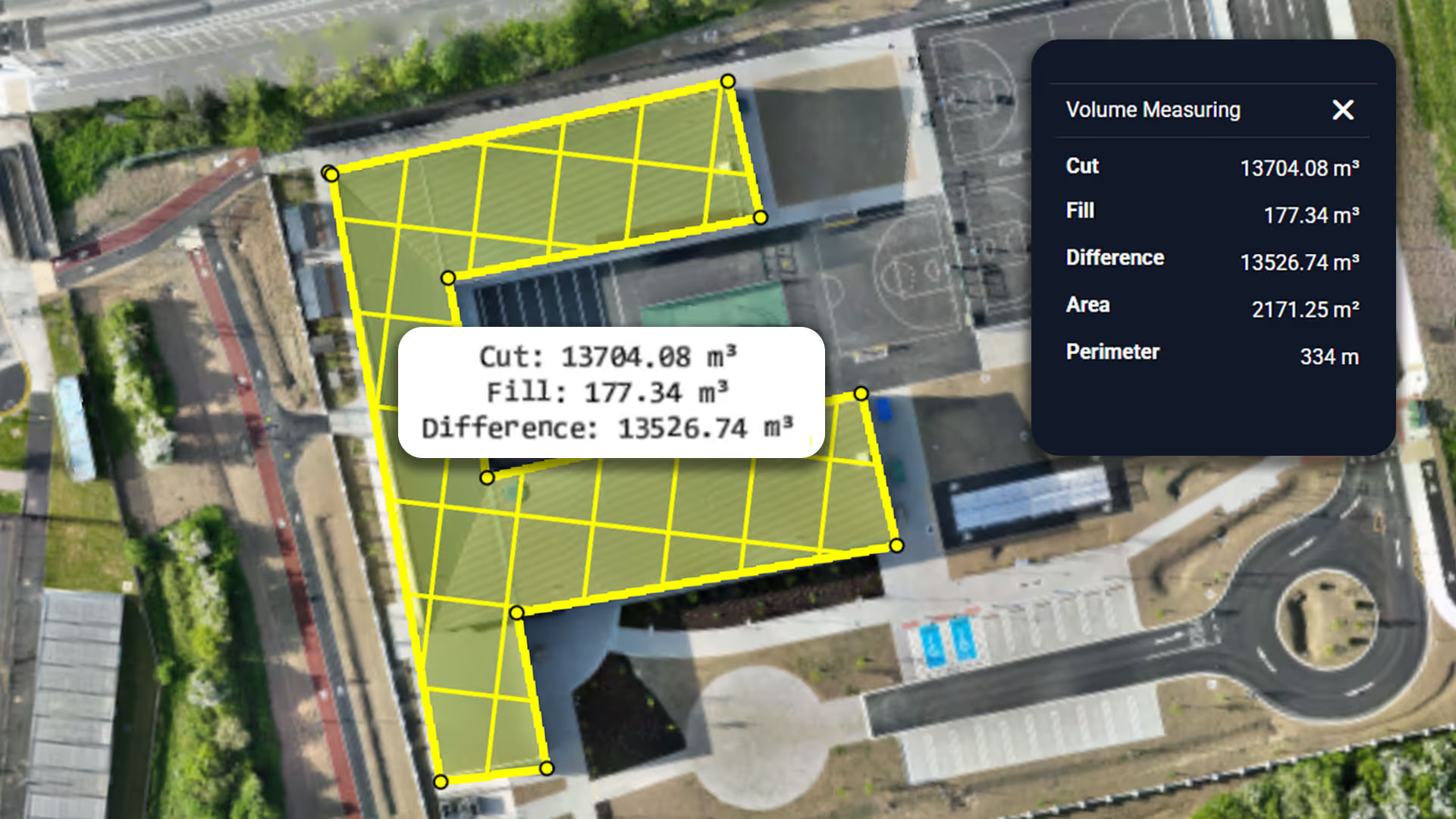
Volumetric Analysis
Get more done with Evercam
Precise volume calculations for earthworks, stockpiles, and material tracking
Distance
Area
Volume
Perimiter
Progress Monitoring
Get more done with Evercam
Track construction progress with regular drone surveys and comparative analysis
Weekly or monthly captures
Side-by-side comparisons
Commenting and markup
360 aerial shots
How Drone Surveys Work
Planning
We suggest optimal flight paths based on your site layout and objectives
Site Scanning
Certified pilots conduct automated drone flights capturing high-resolution imagery
Processing
Advanced photogrammetry software processes images into maps, models, and analytics
Delivery
Access your data through our platform with measurement tools and sharing options
Get the Best Drone View Features with Evercam
Comprehensive visibility lets you build smarter with fewer mistakes.
Distance, Area, Volumetrics
Upload Flight, Comments, Mark-up, Share Link
2D/3D Mode, Compare, BIM Compare, Inspection Tool
Visibility Across the Full Project Lifecycle
Trusted by construction professionals throughout the duration of the build, from survey to project closeout
Site Survey
Accurate aerial data to understand existing conditions before work begins.
Preconstruction
A clear visual record to support planning, coordination, and early decisions.
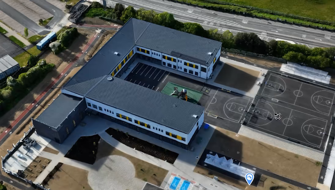
Structures
Ongoing aerial documentation of structural progress as the build takes shape.
Final Handover
A complete visual record of the finished asset for documentation and review.
Recommended Drones
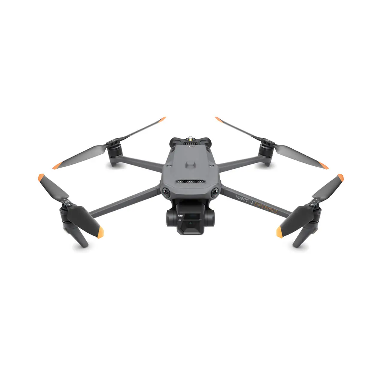
Dual camera system
Advanced obstacle avoidance
56x hybrid zoom

48MP camera, 4K/60fps video
34-minute flight time
Obstacle sensing
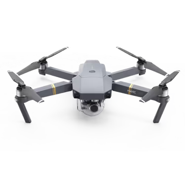
12MP camera
Obstacle sensing
27-minute flight time
Deliverables in 2D and 3D
Get precise 2D outputs for measurement and plan review, and detailed 3D models to understand site levels, terrain, and context. Deliverables include GeoTIFF orthomosaics and OBJ 3D mesh models, generated through photogrammetry and ready for immediate use
2D Outputs
3D Outputs
Why Choose Drone Surveying
Capture the lifecycle of your project with aerial views that you can zoom in on to see the full picture

FAQs
Practical information about how Evercam works, what it does, and how teams use it.
1. How accurate is the measuring tool?
4–6 centimetres per pixel. Higher resolution processing can achieve 2 cm/px, depending on project requirements.
2. What if we are using another provider?
Send us the model as a Textured Mesh Model (preferable to a point cloud model) and the format as .obj or .las. Then send the 2D images as .tif
If you are using Drone Deploy, then can share ADMIN access with us.
3. Do you recommend certain drones?
DJI Mavic 4, DJI Mavic Air 2 and DJI Mavic Pro are all highly compatible drone models. For USA customers, the Parrot ANAFI USA, Skydio X10 & Skydio 2 or 2+ are widely available. DJI drones may be available for purchase through resellers like dronenerds.com.
4. Do you provide flight plan recommendations?
We recommend flight plans and mapping to be used with your preferred app.
5. How secure is the Evercam system?
Evercam is ISO 27001 certified and SOC 2 compliant, demonstrating adherence to internationally recognised information security standards. Customer data is encrypted both in transit and at rest and stored in SOC 2 and ISO-certified data centres. The Evercam platform enforces strict access controls, continuous security monitoring and regular internal and third-party security audits to ensure the confidentiality, integrity and availability of customer data.
See Your Project Clearly From Day One
Schedule a demo and see how drone capture improves visibility, accountability, and outcomes on your next project.